Northeast
Comanche Tribe
Southbridge,
Ma Fly-In
Saturday, Sept 12, 2008 |
Where:
Southbridge, Ma (3B0)
When: Saturday, Sept 12, 2008
10:30 AM - 2
PM
(rain date: Sept 13, 2008)
Activity: Informal
Fun, Food and Friends
* Crosswind Landing Challenge * |
Arrivals -10:30
to noon
Parking - South ramp tie-downs
Lunch - Flyin' Jim's Dinner, Noon to 1:30
Hanger flying - FBO, main hanger
Departure - after
lunch |
|
 |
|
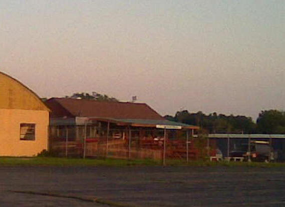
Southbridge is
a nice little airport in central Massachusetts just south of the
Mass Turnpike. Nearby attractions include Old Sturbridge Village
and the "Quiet Corner" of northeast Connecticut. The
hilltop location makes the airport easy to find, and Flyin'
Jim's Diner is very popular with pilots and locals as well. |
|
Check the Worcester (KORH) ATIS (126.55) for winds and
altimeter setting, or monitor Unicom at 122.8. Runway
2-20 has clear approaches from either end. Self-serve 110LL
is found behind the FBO, with parking near the FBO and Jim's Flyin' Diner.
|
|
Southbridge
(3B0)
|
|
SOUTHBRIDGE, MA |
|
Publicly Owned, Public Use |
|
2.0 mi. N of city |
|
N 42-6.06' W 72-2.30' |
|
Mag Var: 14.5 deg W |
|
Phone: 508-765-0226 |
|
Fuel: 100LL |
|
Communication Freqs:
|
|
Unicom - 122.8 |
|
App. BDL - 119.0 |
|
FSS
- BRIDGEPORT 122.2 / 122.4 |
|
|
Elevation: |
699 MSL |
|
Hours: |
1300Z -
dusk |
|
Fees: |
Tiedown Fee, Hangar Fee |
|
Charts: |
NEW
YORK, L26 |
|
Traffic Pattern: |
All
Aircraft: 1700 MSL |
|
Runways: |
|
|
2-20: 3500x75, asphalt,
PAPI, trees |
|
10-28: turf, closed |
|
Approaches: Vor-B from PUT |
|
Navaids: |
|
Type: |
ID: |
Freq: |
Radial: |
Distance: |
|
VOR |
PUT |
117.4 |
329 |
12.3 mi. |
|
|